
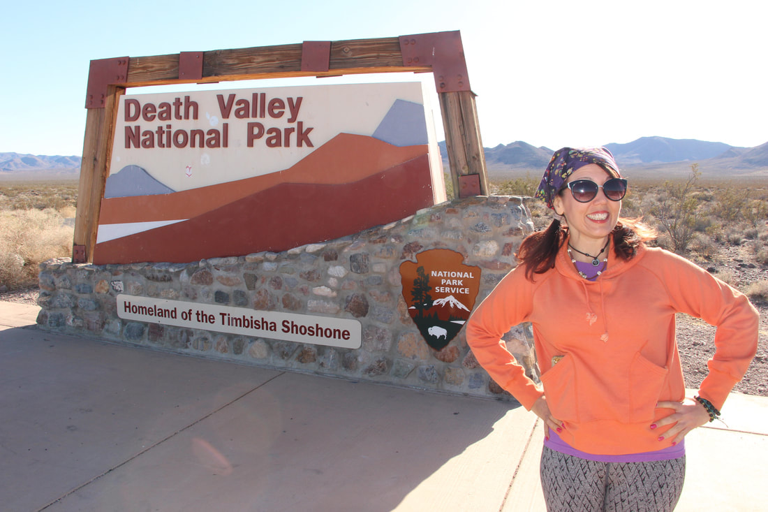
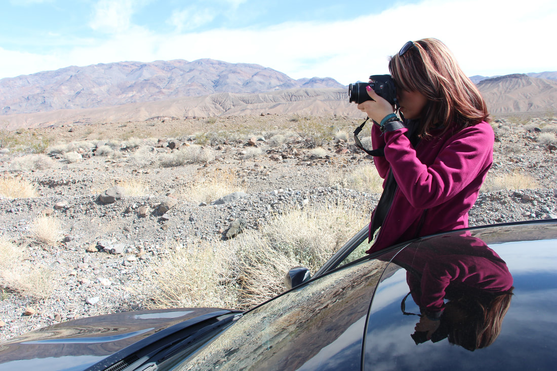
Well folks I'm baaaaaaack from out in the middle of nowhere!
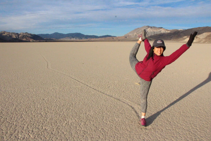
As you know, I've been traveling and exploring in Death Valley National Park.
I left off with you on Friday when we were heading out to the very lowest point in all of North America, in a place that had little to no cell phone signal and is pretty much a real bonafide no mans land!
I left off with you on Friday when we were heading out to the very lowest point in all of North America, in a place that had little to no cell phone signal and is pretty much a real bonafide no mans land!
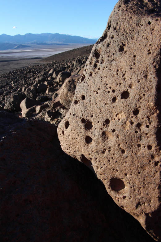
Death Valley is the hottest and driest place in North America because of its lack of surface water and its low relief. It is so frequently the hottest spot in the United States that many tabulations of the highest daily temperatures in the country omit Death Valley as a matter of course. Credit: Wiki
How fascinating is this:
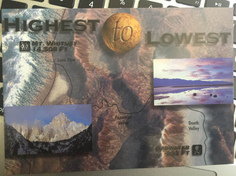
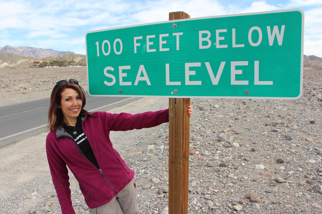
Badwater Basin is at -282 feet below sea level and the lowest place in all of North America and yet it is only 84.6 miles from Mount Whitney, which is the highest point in all the contiguous United States with an elevation of 14,505 feet.
Now tell me that this is not crazy?!
How fascinating is this:
Badwater Basin is at -282 feet below sea level and the lowest place in all of North America and yet it is only 84.6 miles from Mount Whitney, which is the highest point in all the contiguous United States with an elevation of 14,505 feet.
Now tell me that this is not crazy?!
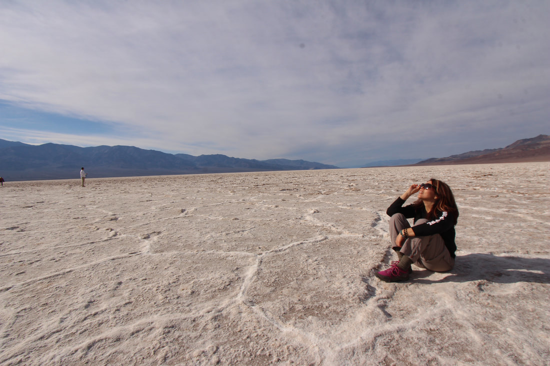
One of my most anticipated stops happened to be Badwater Basin.
Where I made it to the lowest point in North America, -282' below sea level!
Where I made it to the lowest point in North America, -282' below sea level!
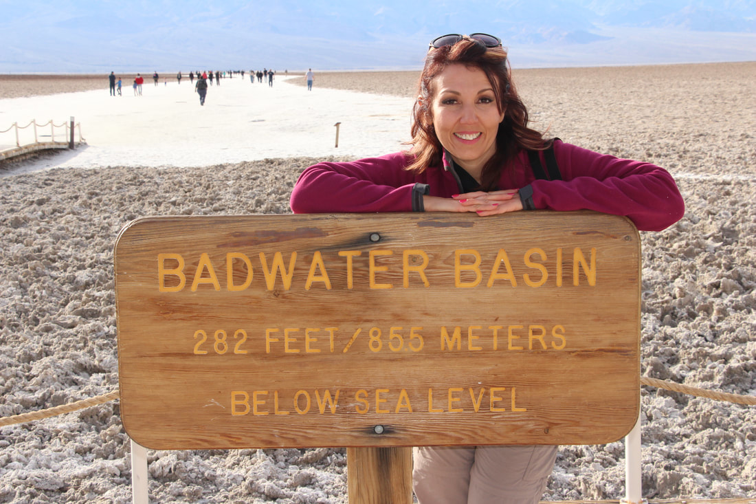
Badwater Basin
A surreal landscape of vast salt flats. With the Black Mountains in the background, there is a shimmering expanse of nearly pure white table salt in Badwater Basin; at 282 feet below sea level, it is the lowest point in North America. Also being possibly the hottest place in the world, with regularly recorded summer temperatures of 120°F (49°C).
A surreal landscape of vast salt flats. With the Black Mountains in the background, there is a shimmering expanse of nearly pure white table salt in Badwater Basin; at 282 feet below sea level, it is the lowest point in North America. Also being possibly the hottest place in the world, with regularly recorded summer temperatures of 120°F (49°C).
I walked and walked in search of what I thought it should look like (from the pictures that I've seen).
I even sat disappointed and pondered. What a bunch of scoundrels. I felt so deceived.
I even sat disappointed and pondered. What a bunch of scoundrels. I felt so deceived.
But...then I learned that passing rainstorms wash off windblown dust and generate a fresh layer of blinding white salt and floods (which they recently had) create temporary lakes that dissolve salts back to solution, starting the process all over again.
So apparently - I came at the wrong time to see the conditions that I wanted to see!
So apparently - I came at the wrong time to see the conditions that I wanted to see!
I also learned Earth’s Lowest Elevations
Dead Sea (Jordan/Israel) -1360 feet (-414 m)
Lake Assal (Djibouti, Africa) -509 feet (-155 m)
Turpan Pendi (China) -505 feet (-154 m)
Qattara Depression (Egypt) -435 feet (-133 m)
Vpadina Kaundy (Kazakstan) -433 ft (-132 m)
Denakil (Ethiopia) -410 ft (-125 m)
Laguna del Carbón (Argentina) -344 ft (-105 m)
Death Valley (United States) -282 ft (-86 m)
Vpadina Akchanaya (Turkmenistan) -266 ft (-81 m)
Salton Sea (California) -227 ft (-69 m)
Sebkhet Tah (Morroco) -180 ft (-55 m)
Sabkhat Ghuzayyil (Libya) -154 ft (-47 m)
Lago Enriquillo (Dominican Republic) -151 ft (-46 m)
Salinas Chicas (Argentina) -131 ft (-40 m)
Caspian Sea (Central Asia) -92 ft (-28 m)
Lake Eyre (Australia) -49 ft (-15 m)
Holy crap I had no idea that the Dead Sea was -1360 below sea level! YIKES!
Let's take a look at some of historic information about this must-see destination!!
In the 1870's the area welcomed the first white settlers, Andrew Laswell and Cal Mowrey.
Looking for water to grow crops and alfalfa for the booming towns in the Panamint Mountains to the west, Laswell and Mowrey developed hay ranches at both Bennett's well and Furnace Creek and were the first to dig irrigation ditches to harness the power of the water in the Furnace Creek area.
Interestingly, ancient settlers, prior to American pioneers stumbled upon and later settled the area, Native people had been here since at least the end of the last Ice Age. The Timbisha Shoshone tribe had called it home for two thousand years.
During the late 1870's, mining camps emerged by entrepreneurial individuals and mining companies.
Today, the remains of the booming towns that once excited, now called "Ghost Towns" are great places of interest to visit.
According to Jenna Blough of Moon Travel Guides, who has traversed through the eastern Mojave looking for these abandoned pieces of history, she lists her Five Death Valley Ghost Towns:
1. Paramint City, California
2. Ballarat, California
3. Chloride City, California
4. Rhyolite, Nevada
5. Gold Point, Nevada
Paramint City, California
Founded between 1873 and 1874, Panamint City had many mills, saloons, stores, a red light district, a cemetery - all built along the uppermost end of the Surprise Canyon.
It was considered a a "bad and wicked" town, with Death Valley on one end of town and the Panamint Mountains on the other end.
On July 24, 1876, a flash flood roared down the canyon and washed nearly the entire town away leaving nothing worth saving and this was pretty much the end of the town.
A road was maintained to Paramint after the big storm, until, in 1993 a series of cloudbursts completely washed the canyon out to bedrock.
The word “Panamint” actually refers to a division of the Shoshenean Indians, also called Koso, who once occupied the Panamint area.
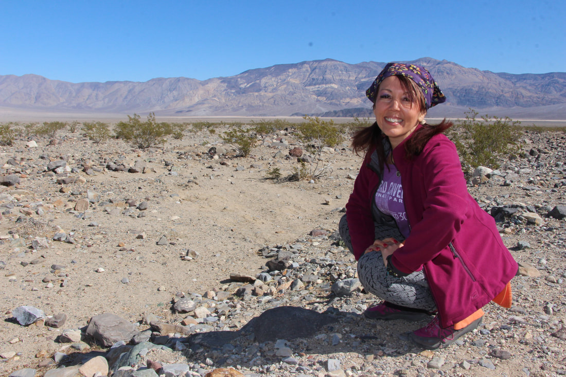
Little did I know what great history there was at this little privately owned "resort"
Little did I know what great history there was at this little privately owned "resort"
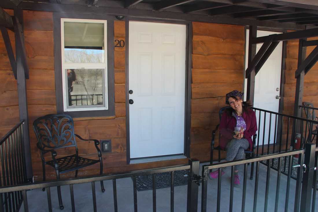
Panamint Springs Resort is the last privately owned establishment inside Death Valley National Park. It was grandfathered in when Death Valley the National Monument (February 11, 1933 - October 30, 1994), became Death Valley National Park on October 31, 1994.
At an elevation of 1,926 Panamint Springs Resort was built in 1937 by Agnes and Bill Reid. Agnes Reid was a cousin of “Buffalo Bill” Cody.
The Reid’s operated this quaint roadside establishment together until the early 1940’s when Bill passed away. In the spirit of strong frontier women, Agnes continued to run the resort alone until 1959. She was known for her warm hospitality, good humor and love of wide open spaces.
In March of 2006, Panamint Springs Resort has been owned and operated by the Cassell Family, who are also known for their warn hospitality, good humor and love of wide open spaces. They rescued this historic resort from its deplorable state and with vision and drive, a new adventure begins in a wondrous land of grand adventures.
Ballarat, California
It was founded in 1896 as a supply point for the mines in the canyons of the Panamint Range. It is located A quarter-mile to the south is Post Office Springs, a reliable water source used since the 1850s by prospectors and desert wanderers.
It was given its name by a young Australian immigrant, George Riggins, who suggested it should be named for Ballarat, Victoria, in the heart of Australia's gold country.
In its hey day, Ballarat had 400 to 500 residents, with seven saloons, three hotels, a Wells Fargo station, post office (that opened in 1897), a school, a jail and morgue, but no churches. Ballarat was a place for miners and prospectors in the area to resupply and relax.
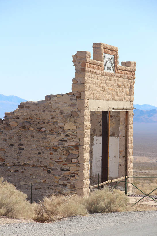
Chloride City, California
This town was established in 1905 when the Bullfrog, Nevada, gold discovery brought people into the area. It is located on the northern end of the Funeral Mountains in a remote part of Death Valley.
This ghost town contains numerous adits, dumps, and the grave of James McKay, of whom, ironically, nothing is known. The town also holds the remains of three stamp mills, but mostly, just a few crumbling buildings are left.
Rhyolite, Nevada
Located in the Bullfrog Hills, about 120 miles northwest of Las Vegas, near the eastern edge of Death Valley. And although considered a Death Valley Ghost Town, Rhyolite happens to be just outside the boundary of Death Valley National Park. 35 miles from the Furnace Creek Visitor Center and just across the state line of Nevada.
It was founded in 1896 as a supply point for the mines in the canyons of the Panamint Range. It is located A quarter-mile to the south is Post Office Springs, a reliable water source used since the 1850s by prospectors and desert wanderers.
It was given its name by a young Australian immigrant, George Riggins, who suggested it should be named for Ballarat, Victoria, in the heart of Australia's gold country.
In its hey day, Ballarat had 400 to 500 residents, with seven saloons, three hotels, a Wells Fargo station, post office (that opened in 1897), a school, a jail and morgue, but no churches. Ballarat was a place for miners and prospectors in the area to resupply and relax.
Chloride City, California
This town was established in 1905 when the Bullfrog, Nevada, gold discovery brought people into the area. It is located on the northern end of the Funeral Mountains in a remote part of Death Valley.
This ghost town contains numerous adits, dumps, and the grave of James McKay, of whom, ironically, nothing is known. The town also holds the remains of three stamp mills, but mostly, just a few crumbling buildings are left.
Rhyolite, Nevada
Located in the Bullfrog Hills, about 120 miles northwest of Las Vegas, near the eastern edge of Death Valley. And although considered a Death Valley Ghost Town, Rhyolite happens to be just outside the boundary of Death Valley National Park. 35 miles from the Furnace Creek Visitor Center and just across the state line of Nevada.
Founded in 1904 and dead by 1916, Rhyolite was one of several short lived boom-towns from the late Gold Rush era. Thousands of gold-seekers, developers, miners and service providers flocked to the Bullfrog Mining District during the gold rush, as it lay near the region's biggest producer, the Montgomery Shoshone Mine.
People were drawn to the desert on the edge of Death Valley by the promise of gold found amongst quartz in local mines, and by 1906 the town had all the promising indicators of permanence with largest population in the area.
People were drawn to the desert on the edge of Death Valley by the promise of gold found amongst quartz in local mines, and by 1906 the town had all the promising indicators of permanence with largest population in the area.
Today, the ruins have been used in many films. The railroad depot and other buildings, and the Bottle House, which the Famous Players Lasky Corporation, the parent of Paramount Pictures, restored in 1925 for the filming of a silent movie, The Air Mail. The ruins of the Cook Bank Building were used in the 1964 film The Reward and again in 2004 for the filming of The Island.
Gold Point, Nevada
The area that would become Gold Point was first settled by ranchers and a few miners during the 1880s.
The small camp of Lime Point was formed a few hundred yards west of the present town, at an outcropping of limestone.
In the early 1900's when new discoveries of gold and silver established the major mining towns of Tonopah and Goldfield, Nevada, at which point a flood of prospectors returned to Lime Point.
Today, about 50 buildings still stand, including former Senator Harry Wiley's home and the post office that now serves as a museum. The Post Office Museum is open on most weekends and for large parties. Memorial Day Weekend is the annual Chili Cook-Off with prizes and drawings, food and drink, games and live music all day and through the night.
Now let's look at how Death Valley got its ominous name. In 1949, a party of pioneers hitched up their wagons and headed west in search of gold.
A group of people decided to follow what they thought was a "short cut" map, on the advice of a young man in the caravan.
Instead of a short cut, the map proved inaccurate and led them into an uncharted area. For months they traveled with lack of water and food, which led them to the brink of thirst and starvation.
Legend says that as they finally made their way out, someone stood on a hill and yelled “Goodbye, Death Valley” giving this area its infamous name.
As the pioneers struggled, desperate for water, they eventually found relief in the springs at Furnace Creek.
During my first visit to Death Valley National Park we actually stayed at Furnace Creek.
Furnace Creek
In 1927, a borax company at Furnace Creek Ranch turned its crew quarters into lodging that would soon become the Furnace Creek Inn. Surrounded by the Panamint and Funeral Mountains, there's a saloon, general store, Borax Museum, spring-fed swimming pool, golf course, a stables and much more...However as you can imagine - they are only open seasonally!
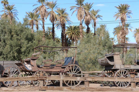
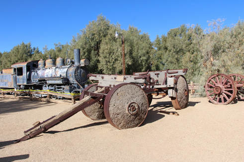
Death Valley National Park and the Twenty Mule Teams...
I'm sure you have heard the expression "twenty mule team" - well, do you know where that expression came from? It actually has its roots in Death Valley.
Twenty-mule teams were teams of eighteen mules and two horses attached to large wagons.
Back in 1883 through 1889 (six years), these "big teams" hauled borax from the Harmony Borax Works near Furnace Creek to the railhead near Mojave - a grueling 165 mile - ten day trip across undeveloped roads.
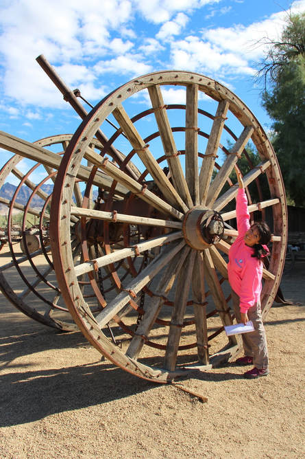
Twenty mules were able to pull approximately 40 tons. Each wagon measured 16 feet by 4 feet by 6 feet deep and weighed 7800 pounds empty and when loaded with ore, the total weight of the mule train was 73,200 pounds.
To put the size in perspective - the back wheels were about 7 feet tall, front ones is 5 feet and each one weighed 1000 pounds each.
The twenty mule team has become an everlasting symbol of the Old West, primarily due to two factors. The advertising campaign in promoting 20-Mule-Team Borax Soap and the long-running Death Valley Days radio and television program.
Today, the last remaining wagons in Death Valley can be seen in in front of Furnace Creek Ranch and at Harmony Borax Works.
I'm sure you have heard the expression "twenty mule team" - well, do you know where that expression came from? It actually has its roots in Death Valley.
Twenty-mule teams were teams of eighteen mules and two horses attached to large wagons.
Back in 1883 through 1889 (six years), these "big teams" hauled borax from the Harmony Borax Works near Furnace Creek to the railhead near Mojave - a grueling 165 mile - ten day trip across undeveloped roads.
Twenty mules were able to pull approximately 40 tons. Each wagon measured 16 feet by 4 feet by 6 feet deep and weighed 7800 pounds empty and when loaded with ore, the total weight of the mule train was 73,200 pounds.
To put the size in perspective - the back wheels were about 7 feet tall, front ones is 5 feet and each one weighed 1000 pounds each.
The twenty mule team has become an everlasting symbol of the Old West, primarily due to two factors. The advertising campaign in promoting 20-Mule-Team Borax Soap and the long-running Death Valley Days radio and television program.
Today, the last remaining wagons in Death Valley can be seen in in front of Furnace Creek Ranch and at Harmony Borax Works.
Another location that really had me curious was Racetrack Playa to see the "sailing stones" - only an 82 mile drive from the Furnace Creek...yet it was suppose to be a 3.5 hour drive (one way)!
And being that the Ubehebe Crater and Tea Kettle junction were also out in that direction why not add those stops as well?!
I was hoping that the drive time was a typo, but in the Visitors Guide it states that once you leave pavement from Ubehebe Crater the drive will take approximately 2.5 hours one-way to the Racetrack!
WHAT?! It's only 27 more miles!!!
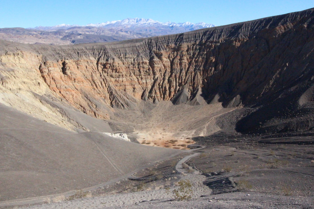
Ubehebe Crater
Just a few hundred years ago a massive volcanic explosion caused by magma mixing with the underground spring, shattered the silence of northern Death Valley. When the cinders and dust settled, this 600 foot deep crater remained.
I was hoping that the drive time was a typo, but in the Visitors Guide it states that once you leave pavement from Ubehebe Crater the drive will take approximately 2.5 hours one-way to the Racetrack!
WHAT?! It's only 27 more miles!!!
Ubehebe Crater
Just a few hundred years ago a massive volcanic explosion caused by magma mixing with the underground spring, shattered the silence of northern Death Valley. When the cinders and dust settled, this 600 foot deep crater remained.
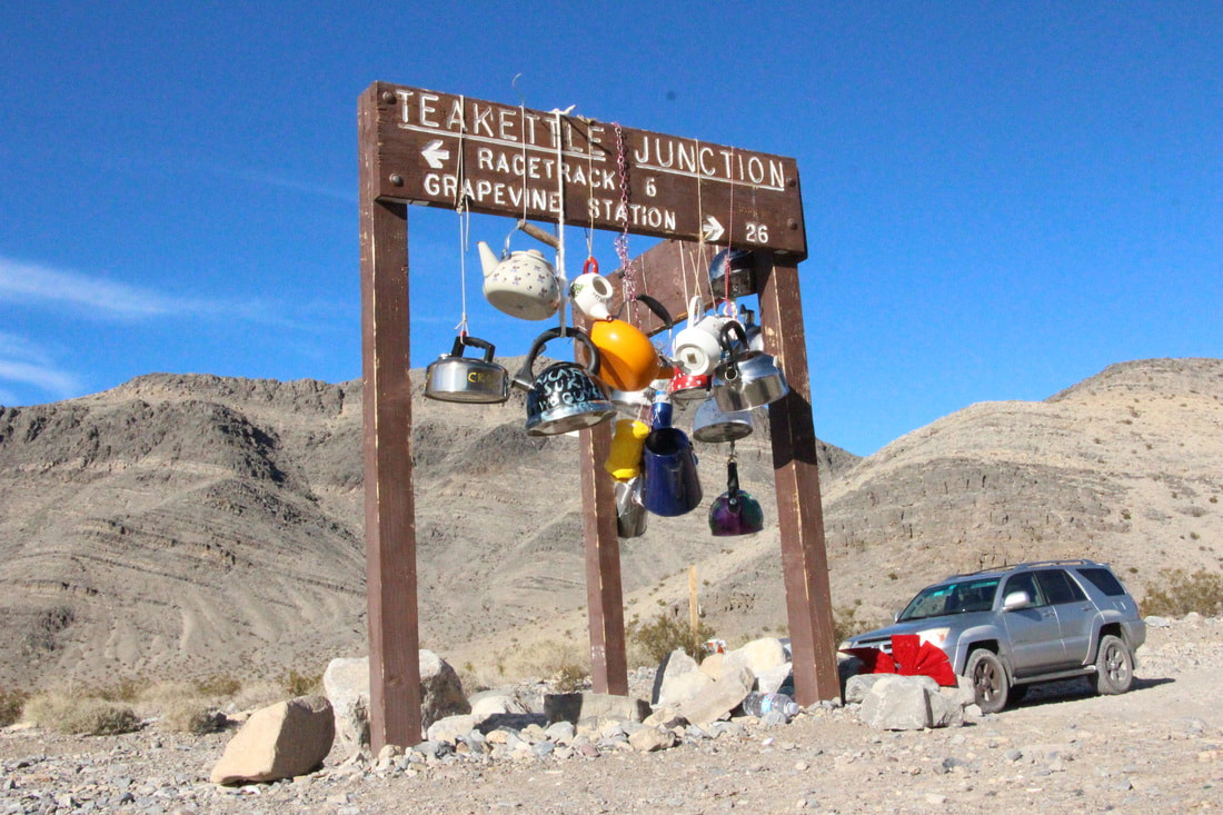
Tea Kettle Junction
Just one of those unique places out in the middle of no where that attracts tourists (like myself) to stop and check it out while heading to the Racetrack Playa. Little is known of the history of the junction, but it's been said to have started to show early settlers that water is near.
Just one of those unique places out in the middle of no where that attracts tourists (like myself) to stop and check it out while heading to the Racetrack Playa. Little is known of the history of the junction, but it's been said to have started to show early settlers that water is near.
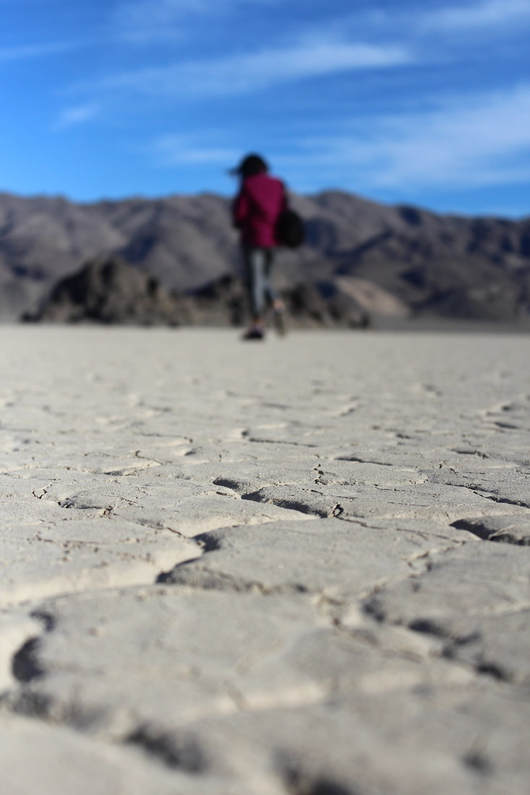
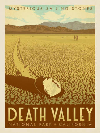
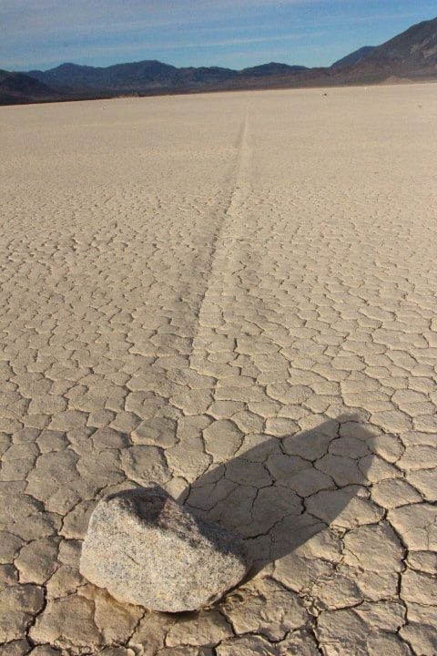
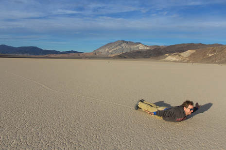
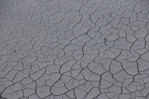
Racetrack Playa
Nestled between the Cottonwood Mountains to the east of and the Last Chance Range to the west, contains boulders that have puzzled geologists for decades. Furrows in the mud indicate that these boulders have wiggled, jiggled, slipped, and slid their way across the perfectly flat lakebed. Leaving behind a long trail for visitor to ponder.
And for the record it did NOT take 3.5 hours! And certainly not 2.5 hours from the Ubehebe Crater! In fact from the crater it only took a little more than an hour.
Of course I had to see more...
Devil's Golf Course
The floor of Death Valley is a vast evaporating dish covering more than 200 square miles. It is crusted over with a variety of salts, and nowhere is this more apparent than at Devil's Golf Course. The lumpy salt pinnacles are the residue of Death Valley's last significant lake, which evaporated 2,000 years ago.
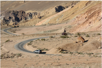
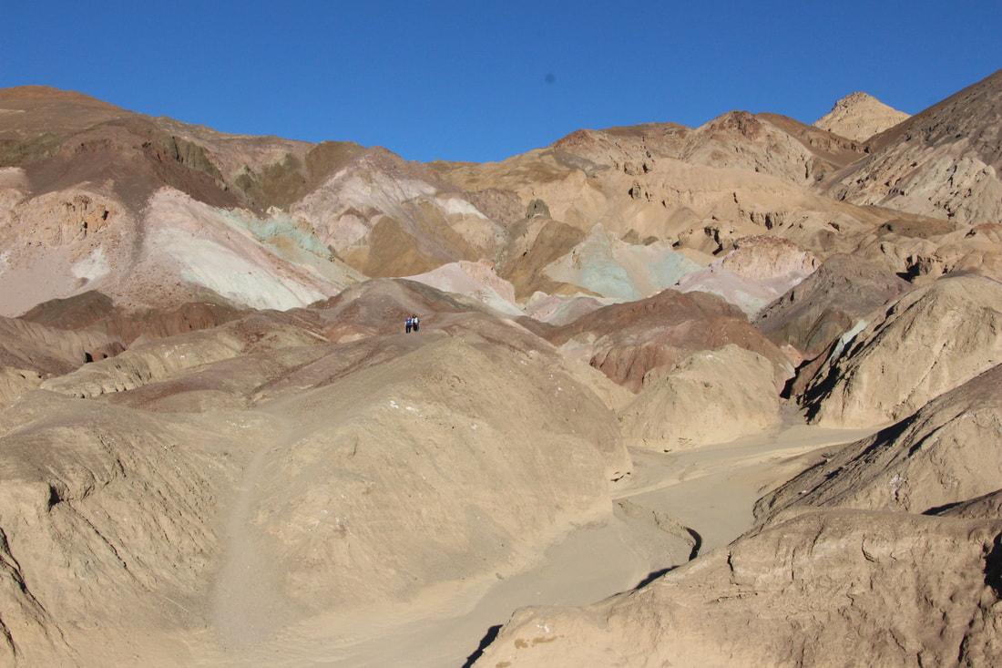
Artist's Drive
A scenic loop drive through multi-hued volcanic and sedimentary hills. Here you'll find a striking array of colors which are brilliant!
Devil's Golf Course
The floor of Death Valley is a vast evaporating dish covering more than 200 square miles. It is crusted over with a variety of salts, and nowhere is this more apparent than at Devil's Golf Course. The lumpy salt pinnacles are the residue of Death Valley's last significant lake, which evaporated 2,000 years ago.
Artist's Drive
A scenic loop drive through multi-hued volcanic and sedimentary hills. Here you'll find a striking array of colors which are brilliant!
So after the first visit this is what I thought...
6 thoughts about my visit to Death Valley National Park
6 thoughts about my visit to Death Valley National Park
- It was quite picturesque.
- Not as boring as was expected. Not at all boring.
- Thought this would be my first and last visit to this park. I was wrong. I plan on returning!
- Nothing was as expected - 4A. The sliding rocks at Racetrack Playa were quite a bit smaller than expected. 4B. The "golf balls" on Devils Golf Course were quite a bit larger than expected. 4C. Badwater Basin looked nothing - not a thing like I expected. 4D. Sunrise and Sunset came later & earlier than posted - screws up your sunrise and sunset shots...especially sunset. 4E. I surprisingly got cellular signal AT&T) a few random times within the park.
- I went into each and every single gift shop / general store looking for a women's cut tee shirt that had park facts on it - Hottest/Driest/Lowest place in America and could not find anything of the sort. I found men's and kids, but nothing for women. I got a keychain! Lmao (and some other stuff - but nothing else with the "facts").
- The most amazing nights sky EVER!
Then during my second visit to the park I had some rather loose "plans" of seeing a few sites that I had yet to explore...
As luck would have it Dave and I were in a rental (a brand spanking new rental with only 53 miles on it at that). Well we were gonna do a bit of breaking her in (on a side note - why are cars always referred to as her?!)
However being that we rented a passenger sedan, there were a few roads that high clearance vehicles were required and that was not us!
So instead of checking out spots that were not particularly typical of what you'd expect at a place like Death Valley - I had to make some last minute adjustments and here's where we went instead:
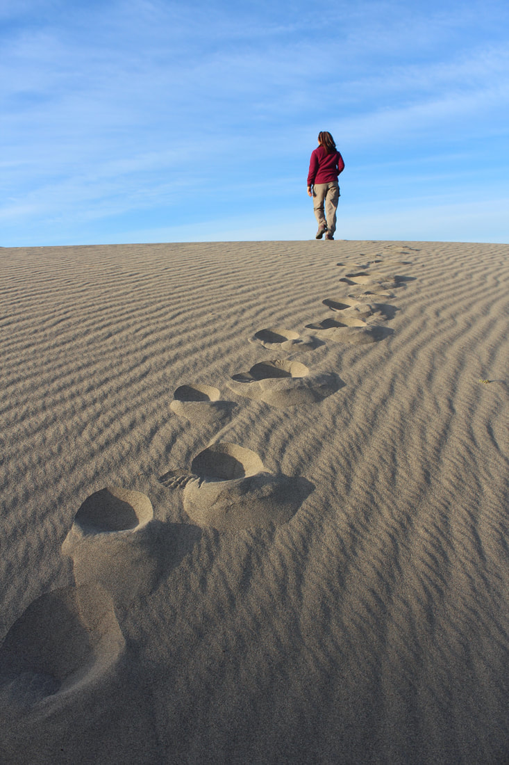
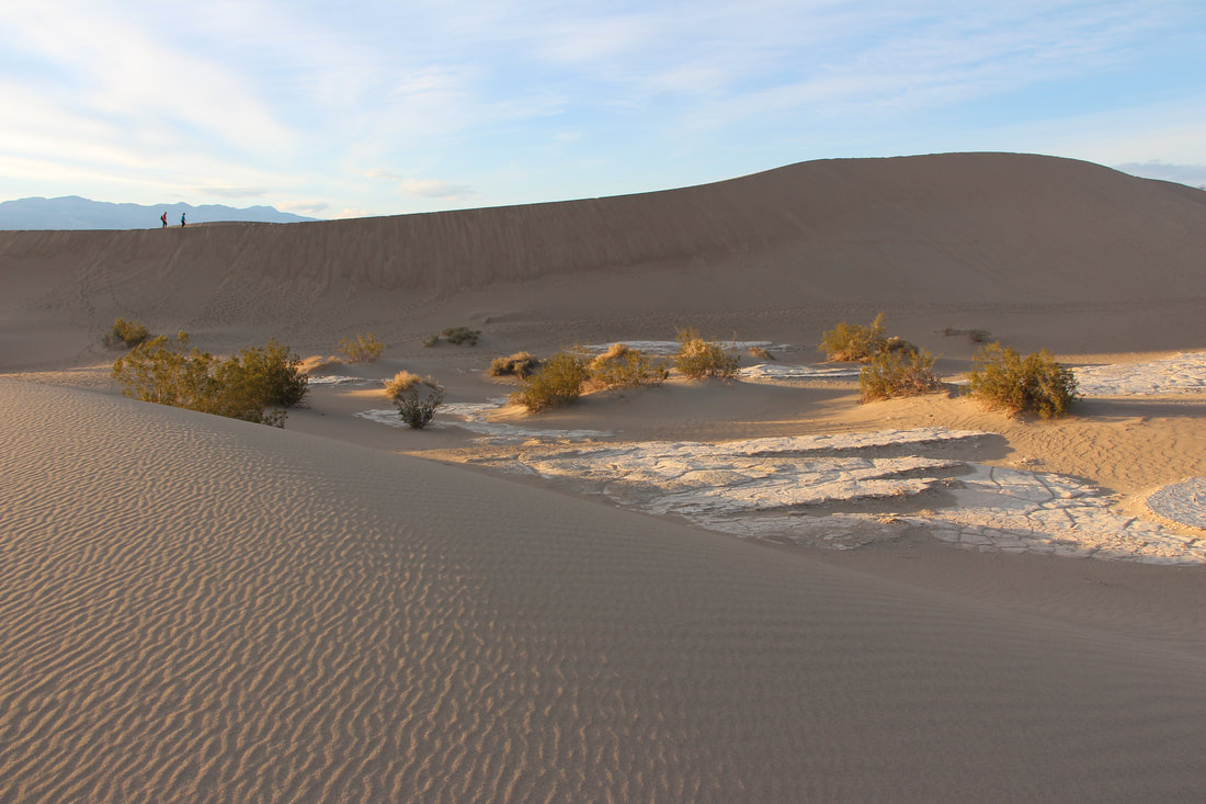
Mesquite Dunes - At the northern end of the valley floor, nearly surrounded by mountains on all sides, these dunes have been used to film sand dune scenes for several movies including films in the Star Wars series.
- The Natural Bridge
- Darwin Falls
- Mesquite Dunes
As luck would have it Dave and I were in a rental (a brand spanking new rental with only 53 miles on it at that). Well we were gonna do a bit of breaking her in (on a side note - why are cars always referred to as her?!)
However being that we rented a passenger sedan, there were a few roads that high clearance vehicles were required and that was not us!
So instead of checking out spots that were not particularly typical of what you'd expect at a place like Death Valley - I had to make some last minute adjustments and here's where we went instead:
Mesquite Dunes - At the northern end of the valley floor, nearly surrounded by mountains on all sides, these dunes have been used to film sand dune scenes for several movies including films in the Star Wars series.
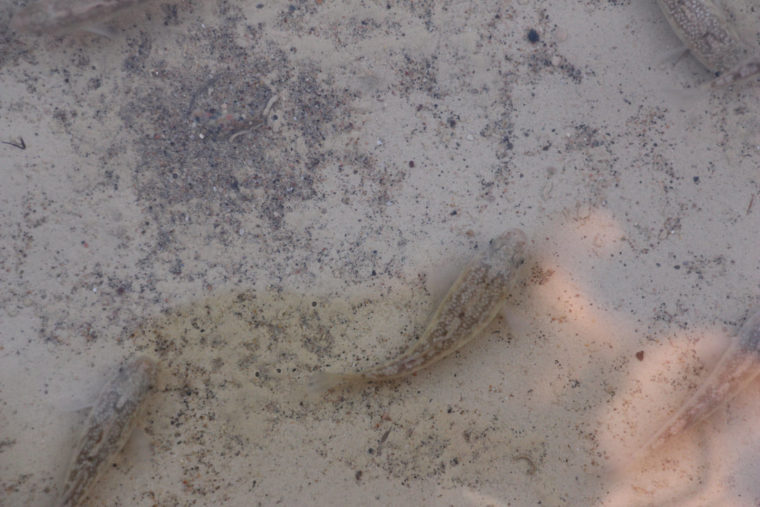
Sand Creek - This stream of salty water is the only home to a rare pupfish, Cyprinodon salinus.
And one resident that I felt quite unlikely to (ever) see is the Devils Hole Pupfish --- an inch long fish that have managed survive in the high heat, mineral rich water with limited food sources for more than 20,000 years!! And yet...
And one resident that I felt quite unlikely to (ever) see is the Devils Hole Pupfish --- an inch long fish that have managed survive in the high heat, mineral rich water with limited food sources for more than 20,000 years!! And yet...
 |  |

All in all there is such an austere beauty to be found at Death Valley National Park.
It's rather curious that it supports any life at all...
When in actuality it serves as home to 51 mammal species, 307 bird species, 36 reptile species, 2 amphibian species and 5 fish species!!!
I'll be on the look out for Bobcat, Desert Bighorn Sheep, Desert Iguana, Kangaroo Rat, Kit Fox, and even the Mule Deer.
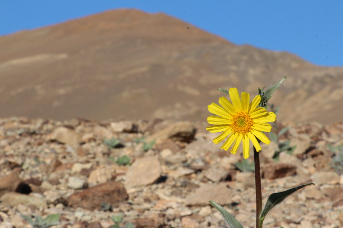
And somehow I even found a tree! A few of them actually. I couldn't believe that I found trees!!
All in all there is such an austere beauty to be found at Death Valley National Park.
It's rather curious that it supports any life at all...
When in actuality it serves as home to 51 mammal species, 307 bird species, 36 reptile species, 2 amphibian species and 5 fish species!!!
I'll be on the look out for Bobcat, Desert Bighorn Sheep, Desert Iguana, Kangaroo Rat, Kit Fox, and even the Mule Deer.
And somehow I even found a tree! A few of them actually. I couldn't believe that I found trees!!
So how are there ANY trees growing in such harsh conditions?
DID YOU KNOW:
Mesquite is an extremely hardy, drought-tolerant plant because it can draw water from the water table through its long taproot (recorded at up to 190 ft in depth).
DID YOU KNOW:
Mesquite is an extremely hardy, drought-tolerant plant because it can draw water from the water table through its long taproot (recorded at up to 190 ft in depth).
16 Fun Facts About Death Valley Nat'l Park
1. In 1994, the "Death Valley" section of the Mojave Desert was named a national park by Congress.
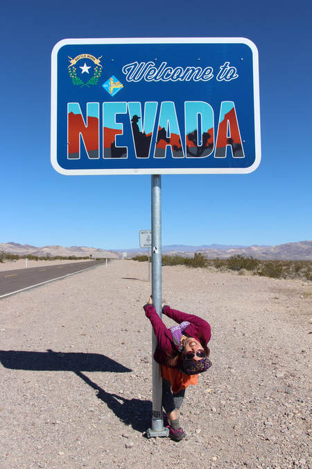
2. Death Valley is on the border of California and Nevada, two hours away from Las Vegas.
3. According to the National Park Service, Death Valley was named by California gold seekers who had to cross the desolate wasteland in order to reach the gold fields in 1849.
4. Death Valley is home to the country’s lowest point, Badwater Basin, which lies at 282 feet below sea level.
5. Death Valley National Park is 3.4 million acres, making it the largest national park in the mainland United States.
6. Death Valley is the hottest place in the country with the highest recorded temperature of 134 degrees Fahrenheit, measured in July, 1913, which also happens to be the highest recorded temperature in the Western Hemisphere.
7. At Furnace Creek near the center of the park, the ground temperature was recorded at 201 degrees on July 15, 1972.
8. Many scenes in the original "Star Wars" trilogy were filmed in Death Valley
9. Home to more than 1000 species of plants (including 50 that are found nowhere else in the world), 300 species of birds, 51 species of mammals (including bighorn sheep and mountain lions), 36 species of reptiles and a few amphibian and fish species.
10. There are nine designated campgrounds in the park and $20 is all it costs to keep your vehicle in the park for a week.
11. There are plenty of roads to travel Death Valley including more than 300 miles of paved roads, 300 miles of dirt roads and several hundred miles of 4x4 roads.
12. There are an estimated 6,000 -10,000 abandoned gold mines in Death Valley.
13. Mount Whitney, the highest summit in both Sierra Nevada and the lower 48 states, is visible from Telescope Peak, according to the National Parks Service.
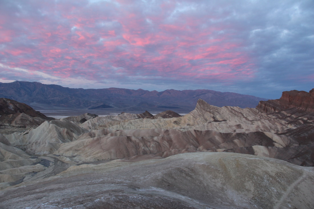
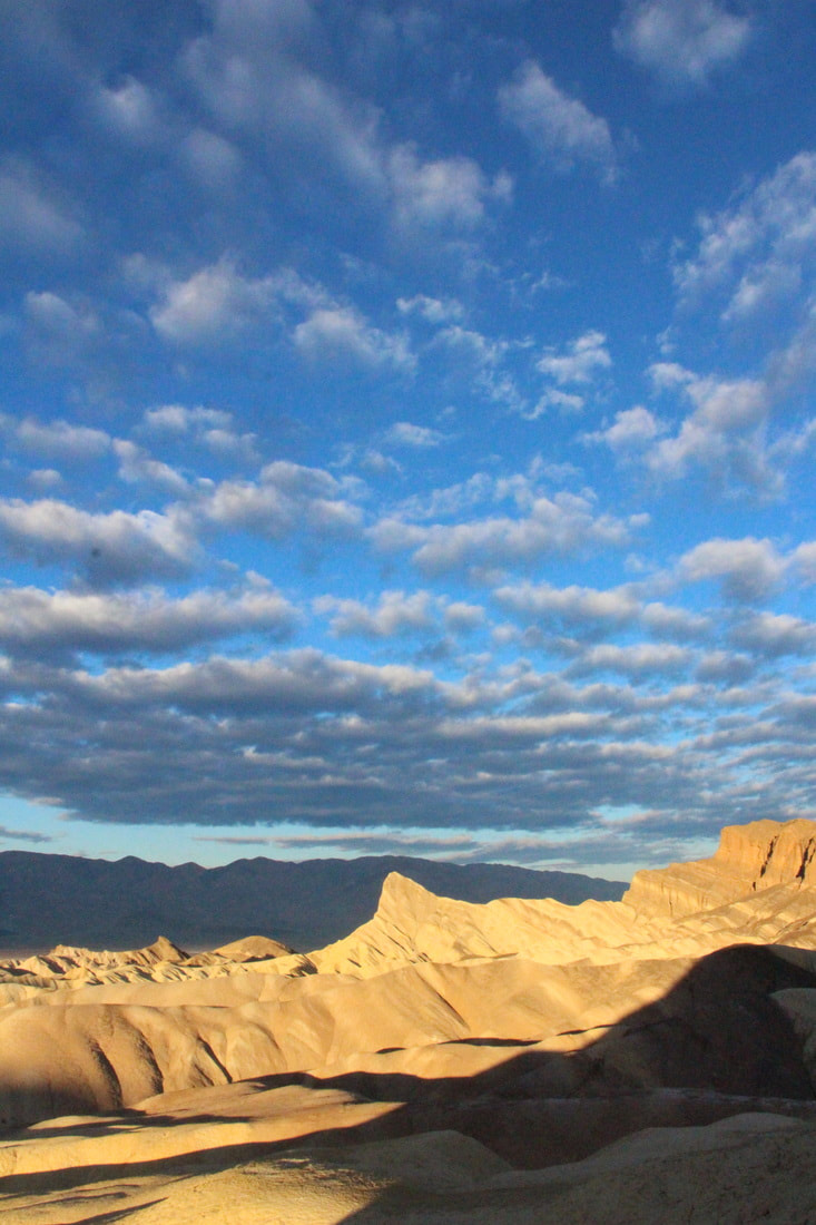
14. Dante's View, Zabriskie Point and the sand dunes are the most popular places to watch the sunset.
15. Scotty's Castle, the former villa of Chicago millionaire and conman, Walter E. Scott offers tours. Built in the early 1900's, the guides dress up in 1930's attire for authenticity.
16. It is recommended that visitors not bring their pets to Death Valley due to the high temperatures and the threat of large mammals.
1. In 1994, the "Death Valley" section of the Mojave Desert was named a national park by Congress.
2. Death Valley is on the border of California and Nevada, two hours away from Las Vegas.
3. According to the National Park Service, Death Valley was named by California gold seekers who had to cross the desolate wasteland in order to reach the gold fields in 1849.
4. Death Valley is home to the country’s lowest point, Badwater Basin, which lies at 282 feet below sea level.
5. Death Valley National Park is 3.4 million acres, making it the largest national park in the mainland United States.
6. Death Valley is the hottest place in the country with the highest recorded temperature of 134 degrees Fahrenheit, measured in July, 1913, which also happens to be the highest recorded temperature in the Western Hemisphere.
7. At Furnace Creek near the center of the park, the ground temperature was recorded at 201 degrees on July 15, 1972.
8. Many scenes in the original "Star Wars" trilogy were filmed in Death Valley
9. Home to more than 1000 species of plants (including 50 that are found nowhere else in the world), 300 species of birds, 51 species of mammals (including bighorn sheep and mountain lions), 36 species of reptiles and a few amphibian and fish species.
10. There are nine designated campgrounds in the park and $20 is all it costs to keep your vehicle in the park for a week.
11. There are plenty of roads to travel Death Valley including more than 300 miles of paved roads, 300 miles of dirt roads and several hundred miles of 4x4 roads.
12. There are an estimated 6,000 -10,000 abandoned gold mines in Death Valley.
13. Mount Whitney, the highest summit in both Sierra Nevada and the lower 48 states, is visible from Telescope Peak, according to the National Parks Service.
14. Dante's View, Zabriskie Point and the sand dunes are the most popular places to watch the sunset.
15. Scotty's Castle, the former villa of Chicago millionaire and conman, Walter E. Scott offers tours. Built in the early 1900's, the guides dress up in 1930's attire for authenticity.
16. It is recommended that visitors not bring their pets to Death Valley due to the high temperatures and the threat of large mammals.
DID YOU KNOW: Death Valley National Park is the largest national park outside of Alaska!
There is so much more to go explore. I really think that you should go check it out!
-Travelin' Tanya
There is so much more to go explore. I really think that you should go check it out!
-Travelin' Tanya
  |   |  |


 RSS Feed